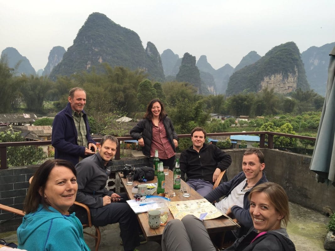
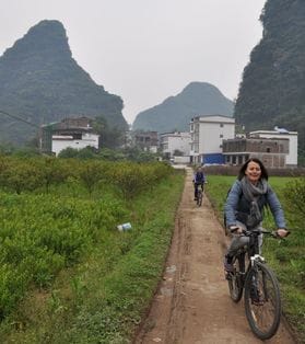
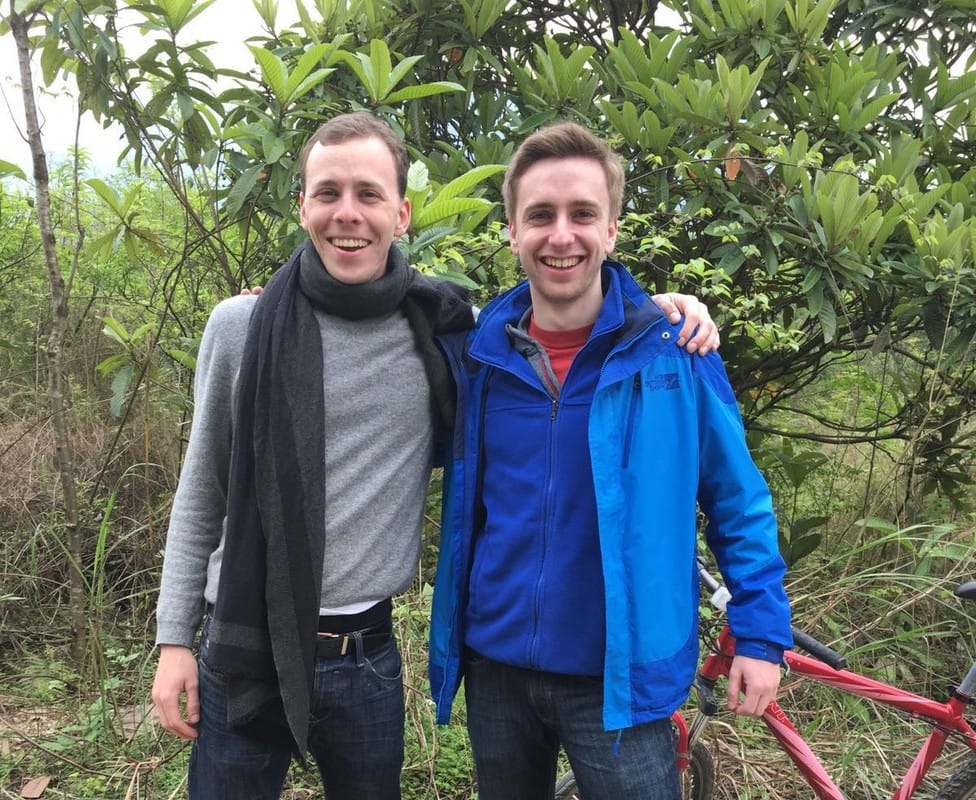
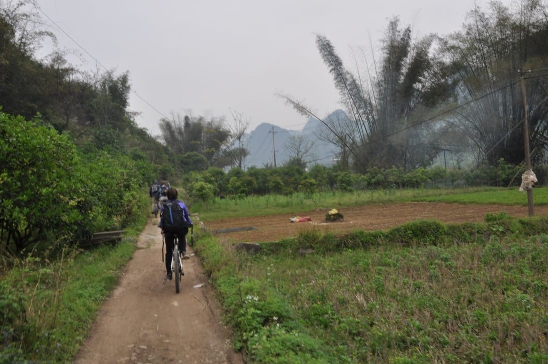
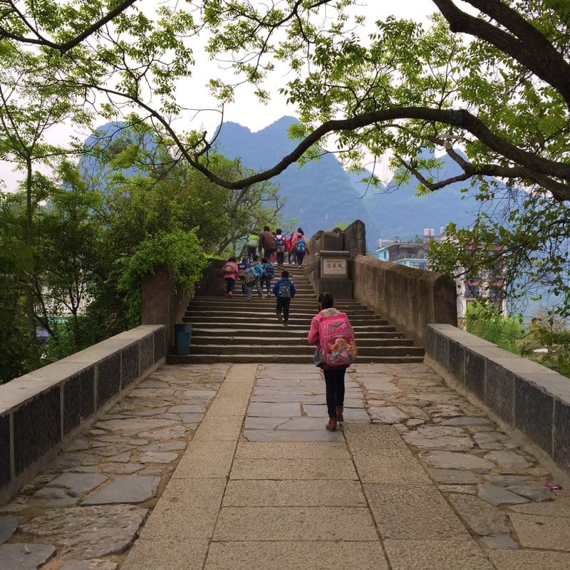
 This one day we spent in China - March 29th, 2016, to be exact - encapsulated so many stories and emotions that it is somehow representative of our whole China trip in miniature. So here they are, the highs and lows, documented for posterity. phase 1: euphoria.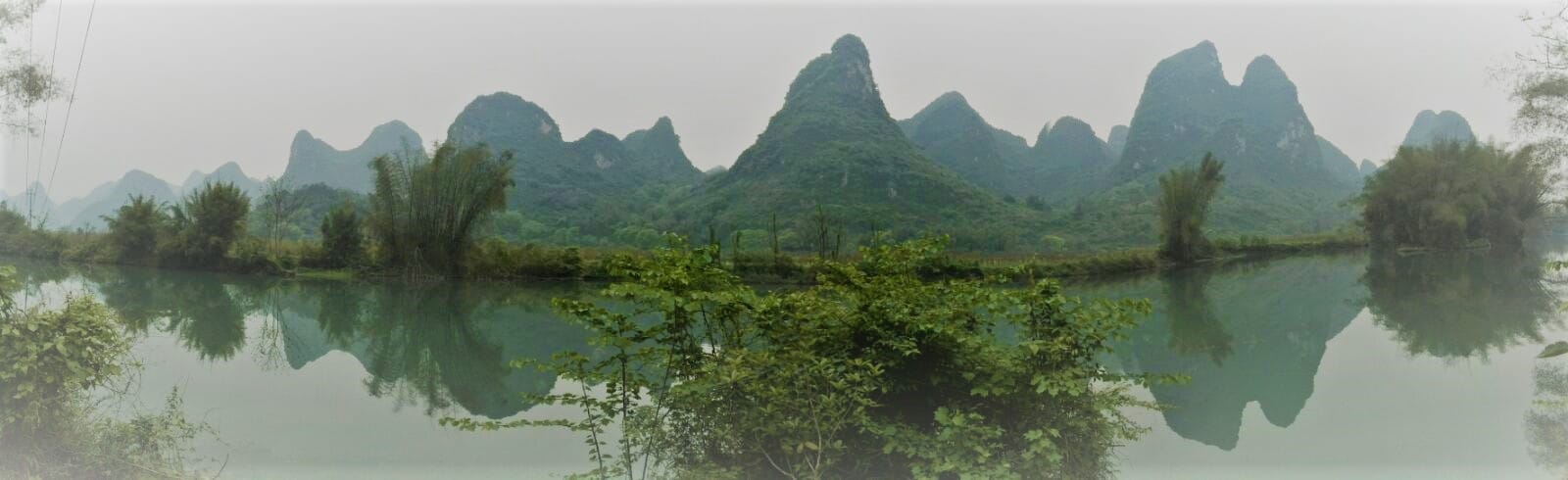 After 10 days spent only in megacities, I think we were all excited to arrive in the lush green of the Yangshuo countryside. Lonely Planet told us that this was a great area for biking, so we were equally excited for a day's excursion by bike - a welcome change of pace from days spent out and about by subway, train, and bus. So we outfitted ourselves with bicycles from our guesthouse, and off we rode!
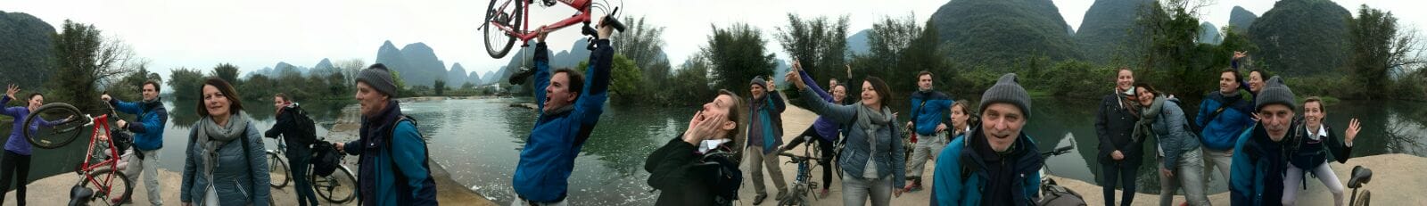
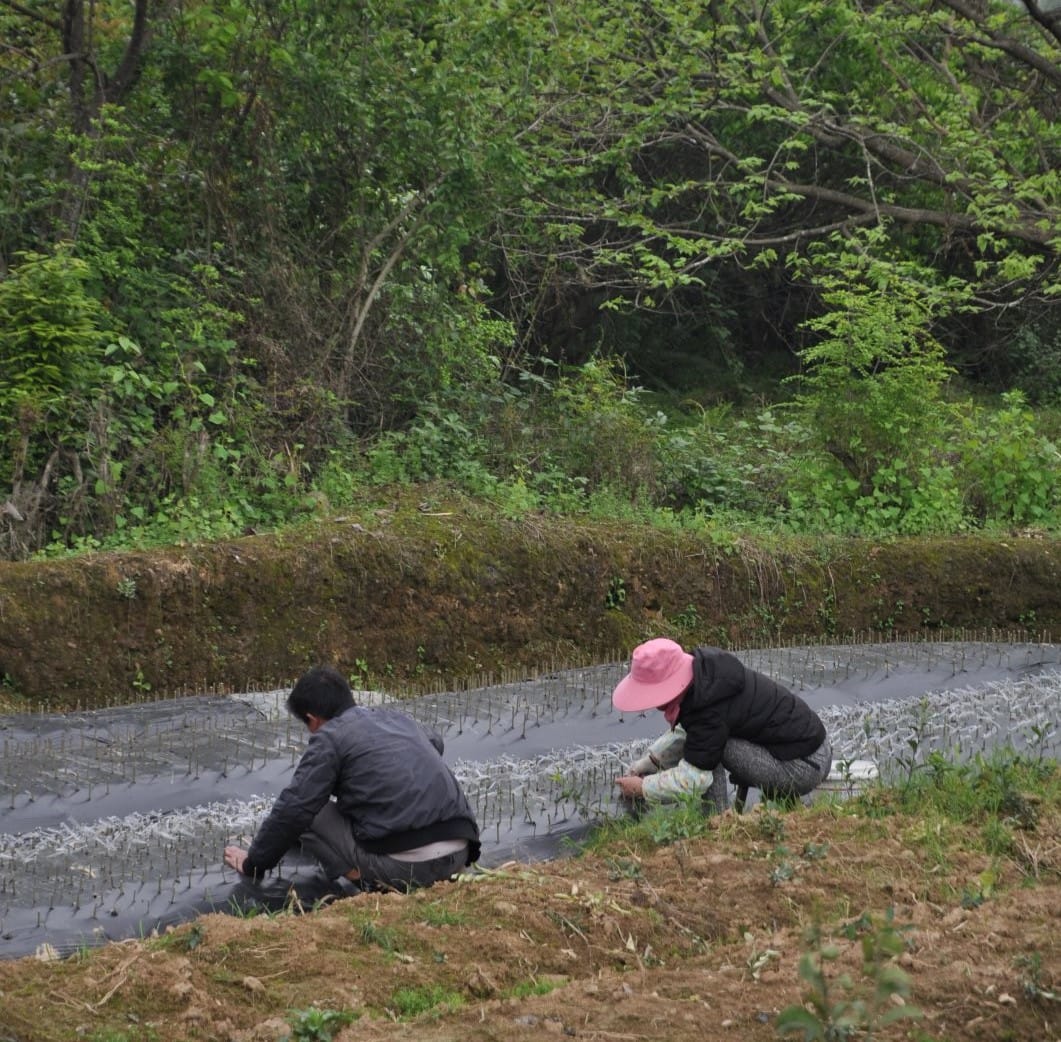
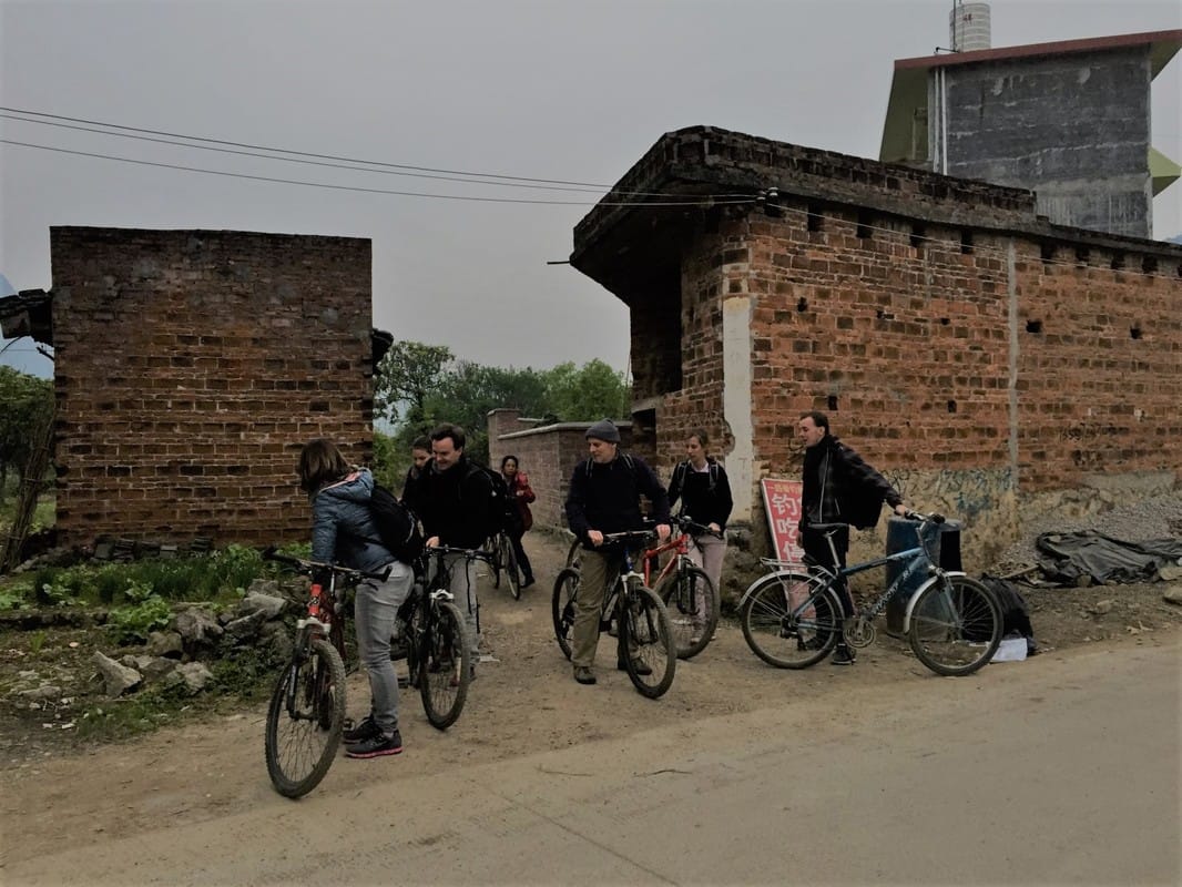
For the first hour, we were all completely euphoric. It was beautiful! We were on bicycles! And at our first photo stop we invented what we were convinced was going to be the next big thing in photography - the panorama shot! Not new, you say? But in our panarama photos, everyone appears more than once, bringing loads of extra fun. The photographer would take a 360° photo using smartphone stitching, and then when someone in the photo was out of the frame (for the first time), they would run to the other end to appear at the other side as well. Pure, silly hilarity. Too bad the photo-stitching software does some weird things to your face when you're in a 360° shot, we could've had some real works of art on our hands. 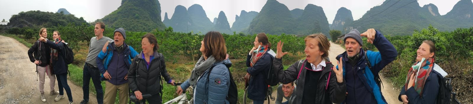 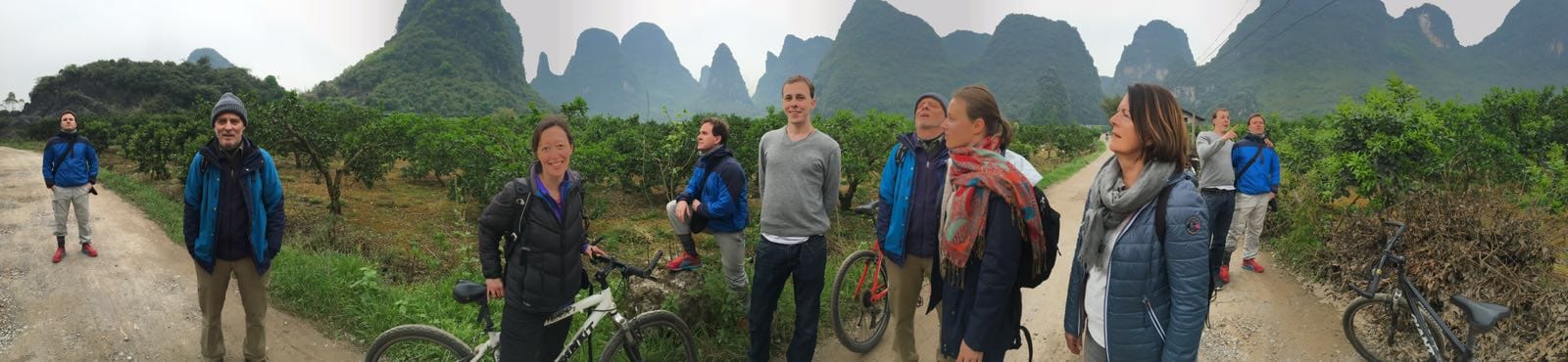 Posing in the orchards of the Yangshuo countryside. phase 2: euphoria tinged with incredulity.The first bit of incredulity crept in when we realized that a good chunk of our bicycle path was not more than a muddy rut strewn with rocks; it was like mountain-biking on flat land. But we were a hardy bunch, and had no problem with walking our bikes once in a while -- which for me, at least, was necessary. We had just finished a long stretch of mud and rocks and had found our way onto a paved path again when we ran into a couple of young white dudes. We stopped to chat about which fork in the road to take, and lo and behold, we actually knew one of them - Roman had gone to high school with one of them in Bühl (i.e., small-town Germany). What a coincidence, right?! I mean, here we were on a bike path in the middle of nowhere (albeit, a middle-of-nowhere that is fairly well known on the tourist circuit), and we meet someone we knew from Germany?! Crazy. Needless to say there was lots and lots of chatting and catching up before we decided it was time to get back on our bikes and make it to our lunch destination, Dragon Bridge. phase 3: frustration, and more incredulity.It was already late when we arrived at our lunch destination, around 2 pm or so, what with all of our stopping for photos and catching up with old friends. Lunch itself didn't arrive so quickly either, so when we had eaten, we were more than ready to get back on the road -- we still had half of our bike ride ahead of us. Dragon Bridge was our turn around point, and the plan was to bike back on the other side of the river. But when we went to get on our bikes again, Verena discovered that she had a flat tire. So we asked a local police officer for help, and he directed us to someone who could repair the flat for us. This took forever, and we started inventing theories that the bike had actually been sabotaged by the people who were now going to make money from repairing it -- we had simply locked our bikes together on one side of the bridge, where some locals had been trying to convince us to come to their lunch place, which we didn't do in the end -- and now it seemed like the same people were doing the bike repair. Also, they found 3 holes in the tube, and apparently charged per hole. The price they named seemed awfully steep to us, so Roman got on the phone with the owners of our guesthouse for the first time that day, and they negotiated a better price for us. By the time all of this was over, we all had a bit of a bad taste in our mouths and were REALLY ready to get on the road again. So we were off again, finally, and the next thing that happened is that we started getting lost. Well, not really lost, but we were having a bit of trouble finding our way. The concept was simple, follow the river back, but the proper path was not that obvious. More than once we went one way, only to have some local farmers to gesture wildly at us, indicating that we should turn around and go the other way. None of this was so bad, but we were starting to feel a bit of time pressure -- we still had a long ways to go and eventually it would get dark.
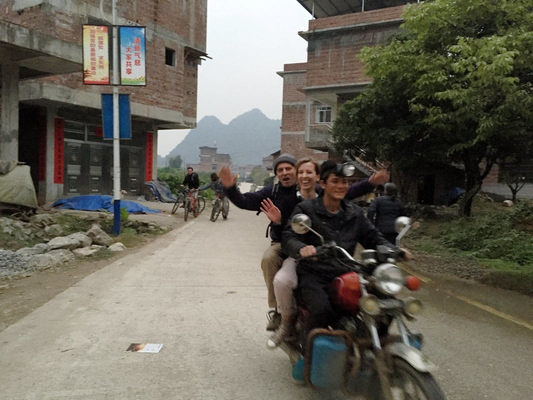
And then Rita got a flat tire. We were somewhere in a tiny village, but we weren't sure where exactly and didn't have any cell phone reception. So we went down the road a bit and found a local farmer who could repair the flat for us. (Mind you, all of this communication was done with sign language and Roman's relatively limited Chinese.) However, the bigger problem was that we still had a long way to get home, didn't exactly know how to get there, and by now it was going to get dark within an hour. And of course we didn't have any lights for our bikes. phase 4: rescue! and even more incredulity.At this point, I was convinced we needed a rescue. Basically, I thought our guesthouse needed to send a van to pick us up. The owners were the most western of any hotel staff we had encountered, spoke excellent English, and I figured we couldn't have been the first guests to ever get ourselves into this sort of fix. So while flat tire #2 was being fixed, I got on the phone with them. As it turns out, however, arranging transport for 7 people + 7 bicycles in rural China is not so simple. So I handed the phone to the nice farmer guy who had just fixed our flat tire, and the plan they worked out for us was this: he would ride on his motorbike with a big giant headlamp and guide us back to our guesthouse. That way we would have light AND not get hopelessly lost. For a moment, Rita was ready to tell him that this wasn't necessary, that we would be fine, but I was convinced - it WAS necessary, and it sounded like a good plan to me.
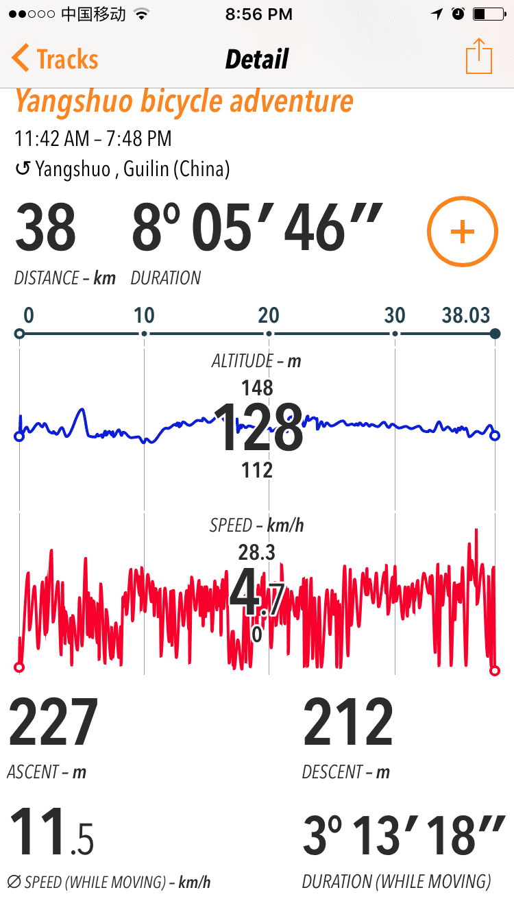
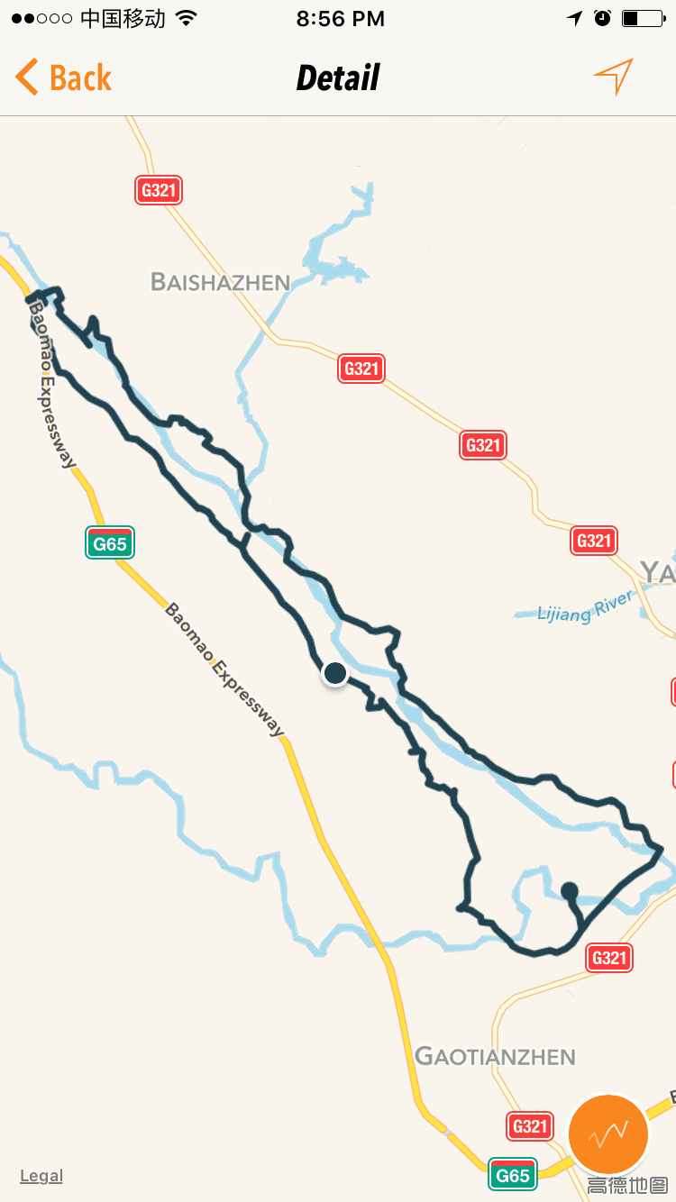
We were on the road again, this time with our new friend as a guide. He led us on a winding path that eventually dumped us out on a proper road, complete with auto traffic. Progress! At this point however, there were two more complications: (1) our guide told us he had to change out his motorbike battery and that he'd be right back, then disappeared, and (2) we had two more flat tires - Rita's (which apparently hadn't gotten properly fixed), and Katrin's. Punch-drunk laughter seemed to be the healthiest reaction here. We weren't off the grid anymore, so Hannes' first thought was to hail down one of the mini trucks that were passing by, to see if they would give a couple of people and a couple of bikes a lift back to our guest house. However, the communication didn't really work, and the truck driver indicated that he could take us down the road to someone who could patch a flat tire...and we had had enough of fixing flats for one day. By that point our new friend had returned, having switched out his electric motorbike for a diesel one. For a moment the plan was this: he would take one extra person on his motorbike, who would roll one of the bikes with the flats along beside them, Roman would ride one bike while pushing another, and Hannes would jog. I'd say we had 8-10 km to go at this juncture. Hannes actually did start jogging down the road while the rest of us biked/rode, but this plan lasted all of about 200 meters. Then we rearranged and did the following: two people got on the back of the motorbike, Hannes and Roman biked while simultaneously pushing a bike with a flat beside them, and the rest of us rode our bikes normally. What a troupe we made. phase 5: relief, exhaustion, and awe.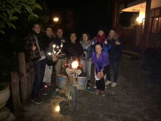 And we made it! We biked/rode in this constellation a while in the dark, finally got to a road that we recognized, and knew we weren't far away. Up until the very end, we had been riding all together in a group, and we had tried to tell our guide that he could go a little faster on his motorbike, that the bicycles could keep up -- but the pace stayed relatively slow. Those actually riding on the back of the motorcycle later hypothesized that maybe our driver spent the whole time being unable to get out of first gear. Because around the last corner he shot off ahead, leaving us on the bicycles behind. When we pedaled into our guesthouse driveway, we were in for one last surprise -- our motorbiking companions hadn't arrived yet. It was our last "oh no!" moment for the day, but we didn't have to wait too long before the last of our crew showed up. Soon enough, they pulled in as well -- they had missed the turnoff to our guest house and had to turn around. We tried to get our new friend and guide to stay for dinner, but he had to turn around and get back to his wife and baby at home. Without his help we would've been lost in more ways than one, and we were SO grateful. We had to insist to get him to take some money in return for his services. Simon had missed all of the shenanigans, having stayed back at the hotel because he wasn't feeling well. In the evening recap and report, after everyone had showered and we were sitting down to eat, the elation came flooding back. The trials of the day made it that much more amazing in the end. I was impressed that, despite all of the complications of the journey, all of us stayed in good spirits throughout -- the only breakdowns were of the bicycle variety. Plus, there's nothing like needing to rely on the kindness of strangers to make me feel warm and fuzzy about humanity. Meanwhile, Lonely Planet describes our bicycle route as a 20-km, 4-hour trip -- which turned out to be a 38-km, 8-hour trip for us. So much for truth in advertising. Of course, only 3 hours and 15 minutes of our trip were actually spent cycling, the rest we spent fixing flat tires. Oh yeah, and stopping for frolicking, taking pictures, and enjoying the view.
0 Comments
As our last hurrah of summer, we spent 5 days kayaking around the island of Milos, Greece. The rhythm of our days went like this: paddle, stop at a beach, go for a swim/snorkel, have something to eat, maybe take a little nap on the beach, repeat. Sun, water, waves, sand. Not a bad deal, really. The original plan was to kayak around the whole island of Milos in 5 days, about 100 km in total. When we arrived, however, there were extremely high winds that were predicted to last the whole week. So our 5-day, 4-night trip got turned into into a 4-day, 3-night trip, plus a day trip at the beginning. This also meant we stayed on the east and southern sides of the island, where we had more protection from the wind. It was disappointing when we heard this would be the revised plan, but in the end I didn't feel like I missed out at all - we stopped at so many beautiful beaches, paddled through so many cave, past so many cliffs. Because we paddled only 60 km instead of 100, we had more time to lounge on the beach and play around in the water. We also used our extra time to practice new paddling strokes and skills - like how to paddle in high wind conditions (hint - don't stop paddling). Even though we stayed on the "sheltered" sides of the island, I have never before experienced such extreme paddling conditions. We'd paddle around a headland and boom - the wind would be directly in our face, and we'd be fighting it. We also got to experience the wind at our backs, where the paddling part wasn't even necessary - we'd hold the paddle up in the air and get pushed as if we were sailing. I hope I'm not giving the wrong impression - there were times when I felt resentful of the wind but a lot of the time it was FUN. Hannes and I were among the most casual of the kayakers on the trip - most of the others logged hundreds of kayak-kilometers a year - but I think we still managed to fit in quite nicely. The trip, which we did through Sea Kayak Milos, is considered an expedition, and did involve sleeping in tents and using nature as our toilet. But for an expedition, it was pretty cushy, I have to say. For instance, our guides did all of the cooking for us. This means we'd land at our camping spot around 4pm, set up tents, and then spend a couple of hours swimming/snorkeling/walking around/having a beer while dinner was prepared for us. (Dinner, by the way, always included an appetizer, main course, and dessert.) Such a luxury compared to my self-organized camping trips! Milos is a populated island with a mining industry, so it's not like we were in the wilderness, but often it still felt very wild...but then every so often one of the beaches we'd land on would have a bar - the perfect combination of nature and civilization.
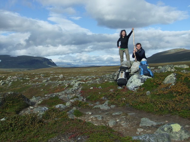 Staking our claim. Hannes and I spent the first week in September in Lappland in North Sweden, above the Arctic Circle - the furthest north I've ever been. We hiked 90 km on a trail called the Kungsleden - "the King's Trail" - between Saltoluokta and Kvikkjok. It was awesome, and I have to say I'd love to be back there now. (That is, if it weren't snowing there already, which it probably is.) The trail is actually fairly easy - elevation gains are minimal, and at 800m or so you're above treeline, meaning you have great views with little effort. Like in the Alps, the area is equipped with mountain huts where you can sleep and cook without having to carry a tent or a stove. Unlike the Alps, there's not a village or a ski gondola around every bend - the area is much more remote, which was to our liking. I love hiking and backpacking and being out in the mountains, but this is the first trip where I got home and wished I was back out on the trail - probably because staying in the huts made it so comfortable. Instead of freezing my hands washing dishes by headlamp in icy water, we were sitting by candlelight at proper tables, playing cards and yatzee and being entertained by the tales of fellow hikers. Another major bonus: being toasty warm from the heat of the wood stove. A luxury for backpacking! I'm quite introverted and don't usually travel with the intention of meeting new people, but this was also one of the few trips where the people we met along the way really helped make the trip. There was a group of 4 smelly Bavarian boys who were taking a break in "civilization" after a couple of weeks off trail in Sarek national park, who were full of high spirits despite all their stories of freezing their butts off and getting lost along the way. I found it entertaining simply to watch how many cookies they could eat in one sitting. There was an older Swedish-Australian couple - in their 70s, at least - who gave us a ride from the end of the trail to the bus station, who had hoped to reach Aktse on their very old, beaten-up bicycles. They hadn't made it all the way but we were impressed that they even tried. (And thankful for the ride, which saved us a 200+ euro taxi ride!) We also enjoyed the company of a self-reliant hiking enthusiast cum Aachener Printen-baker while we spent half the day at the bus stop heading back to Kiruna at the end of the trip. Days 1-2: Stuck in Kiruna.Our trip didn't get off to an auspicious start - when we arrived in Kiruna (via SAS), our hiking packs failed to arrive with us. We had planned to take an early bus the next morning to the trailhead, but without our packs we spent an extra day in Kiruna, doing not very much at all. I admit to being rather unfun and grumpy. Kiruna is a mining town, and it's very obvious when you're there that the town wouldn't exist without the mine. In fact, the mine is planning to expand its operations to underneath what is currently the city of Kiruna, and is going to pay to relocate the town so it's not on top of the mine.    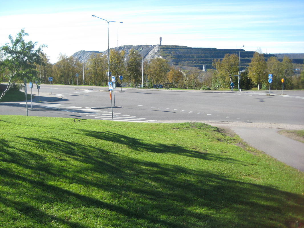 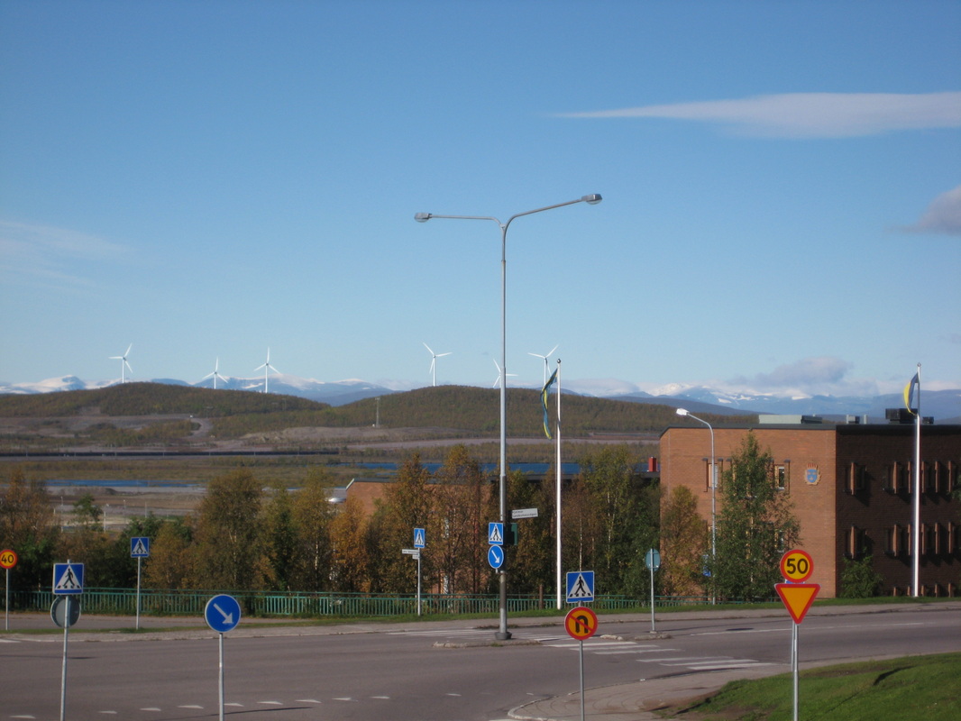 Day 3: On the way to the trailhead in Saltoluokta.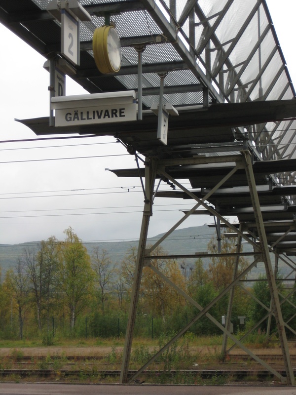 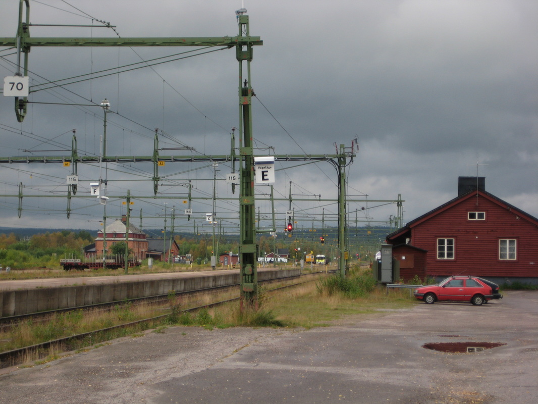 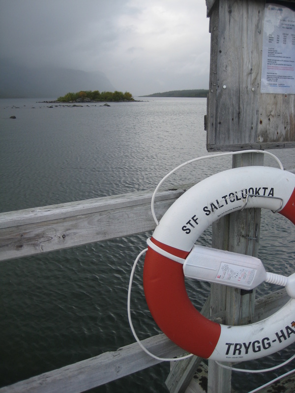  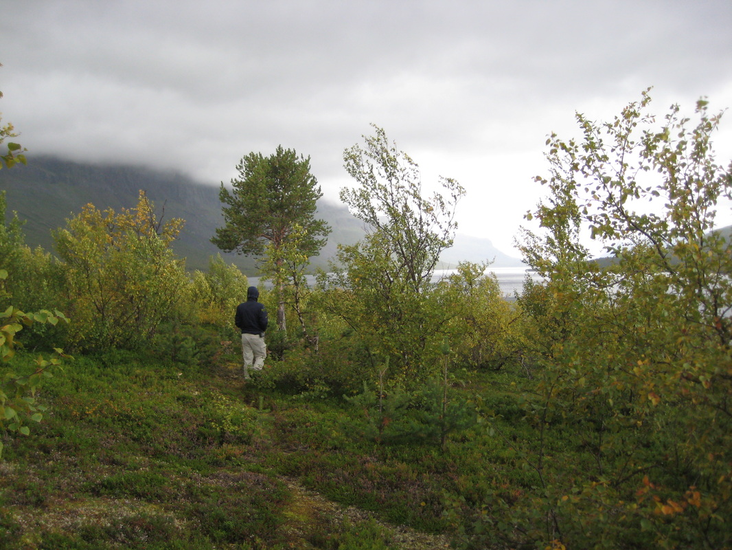  Day 4: Finally on the trail! Saltoluokta to Sitojaure (20 km)2nd day on the trail: Sitojaure to Aktse (4 km rowing, 9 km hiking)This day was our only really rainy hiking day, and luckily it happened to be our shortest hiking day as well. The day started with a first for me: rowing for part of the "trail." It also featured our first reindeer sightings, which was a nice way to distract us from the rain. When we arrived in Aktse we had some time to dry off, relax, and enjoy the view when the clouds cleared in the evening. 3rd day on the trail: Up the Skierfe (16 km)We spent two nights at Aktse hut so we could take a day and climb up the Skierfe. It was a great hike. Parts of the way up felt like walking on the moon, and the view from the top was as impressive as it was scary. Plus, lots more reindeer. 4th day on the trail: Aktse to Parte (4 km by boat, 20 km on foot)Another day that started with a boat ride, only this time we took a motorboat (for a ridiculous sum) because the row boats were all taken. It ended up being a good thing because it was pretty windy out on the water and it was our longest hiking day, so it was nice to get off to an easy and quick start. It was another day of beautiful landscapes but it was SUPER windy above the treeline, which made it a little harder for me to enjoy. 5th and last day of hiking: Parte to Kvikkjok (16 km)This was a typical day for the last day of a backpacking trip - feeling like the exciting stuff was over and ready to be at our destination. We were in the woods the whole time, so no sweeping views like the earlier days. It was still pretty though, and I think it would be a great place for cross-country skiing (which is what people use the huts for in winter). Despite all the comforts of the huts, I was really happy to get a hot shower at the end of the day! Do you want to go too??If you live in the western U.S., there are many other equally beautiful hiking destinations at your doorstep, so there's no real reason to come to Sweden for a hiking trip. However, if you're itching for some European hiking, I would totally recommend the Kungsleden. And in that case, I'm full of advice.
Getting There & Around We flew into Kiruna, which is definitely the closest airport if you're looking to go to Abisko, which is on the north part of the Kungsleden. If we were to do it again, I'd look into flying into Gållivare, which is closer to where we started at Saltoluokta. From Stockholm, it's at least a 12-hour train ride up north. There are bus connections to many trailheads along the Kungsleden, but don't expect there to be a bus more than once a day. I'd recommend adding a few of days of fudge time at the end of your trip because it could take more than a day to get back from the trailhead to a train or airport connection, AND because conditions on the trail might mean that you may not make it as far as you planned. We heard from some people that in bad weather they had to wait multiple days to be able to do a lake crossing (via boat) to get to where they wanted to go. The following are transit websites for the north of Sweden. They'll take a little patience and probably the help of google translate, but they're quite helpful. http://www.ltnbd.se/ http://www.sj.se/ To get a topo map of where we were hiking, I ordered from the following website, which the Swedish Tourist Federation pointed me to. Topo maps are also available at the mountain huts, but they're not any cheaper (though you could save on shipping costs). http://www.kartbutiken.se/kartbutiken/se/ Climate The Kungsleden is above the Arctic Circle, so don't plan on it ever being very warm. We were there the first week in September, and it was around 13°C during the day and close to freezing at night. I wouldn't go during July because the mosquitoes are supposed to be terrible. In August you'd have lots more daylight but I liked being there in September because we got to see a lot of fall colors. The Swedish Tourist Federation The Swedish Tourist Federation maintains the cabins and the trails, and are super helpful for trip planning. I emailed them more than once with questions and they always responded (in English) within a day or so. Their website is also useful, though the English language version isn't as complete as the Swedish version. You can always use the Swedish one with google translate. http://www.svenskaturistforeningen.se/en/ Prices This is Sweden, so everything is expensive. It cost us about 30 euro per person per night to stay in the cabins, which at face value is quite expensive for a dorm bed in a cabin with no electricity and no running water. However, I LOVED it and it felt like money well spent. If you want to tent camp, you don't need a permit and it's free just about everywhere, except in the areas right around the cabins. Some of the STF cabins also have small stores selling food, fuel, and other small items like first aid supplies and postcards. However, it's all quite expensive, so we bought and packed most of our food ahead of time, and used the cabin shops just to resupply on chocolate and other necessities we were low on. Expensive Boats Along the Kungsleden, there are lake crossings by boat, where there are supposed to be rowboats supplied for you to row yourself over. The problem is, there are far too few rowboats (we saw three per lake), and they have a rule where you're always supposed to leave at least one rowboat on each side of the lake. That means if you show up and there's only one rowboat and you're one person, you're screwed. If you show up and you're two people, you're supposed to row over, row two boats back, and then row one boat back to your destination side. This is a pain in the arsch and also time consuming. At all of the lakes you can find people with motorboats who are happy to take you across - for the ridiculous price of 20 euro per person. That seemed to be the standard price no matter who you asked, and they never wavered. This meant that everyone we met in the cabins along the trail was sharing stories about whether they'd had a rowboat available and coming up with schemes to avoid paying for a motorboat. Some of our companions were only half-jokingly talking about setting up a competing hiker-shuttling service using the rowboats. In practice though, unless you are really short on money and have all the time in the world, occasionally paying for a motorboat ride is probably unavoidable. |


 RSS Feed
